Relief Map
Objective: To reflect on the different elements that conform our life experience in relation to our privileges and oppressions.
Duration: 1 hour
Materials: A sheet of paper, markers of different colours.
Development
Relief Maps are conceived as a means of visualizing and analysing data, and a means of conceptualizing intersectionality. It consists of a tool used to carry out searches and, although it is in the form of a graph, it is called a “map”. It is a methodological tool for research with an intersectional perspective. It takes into account three dimensions:
- Psychological (emotions)
- Geographical (places)
- Social (identities)
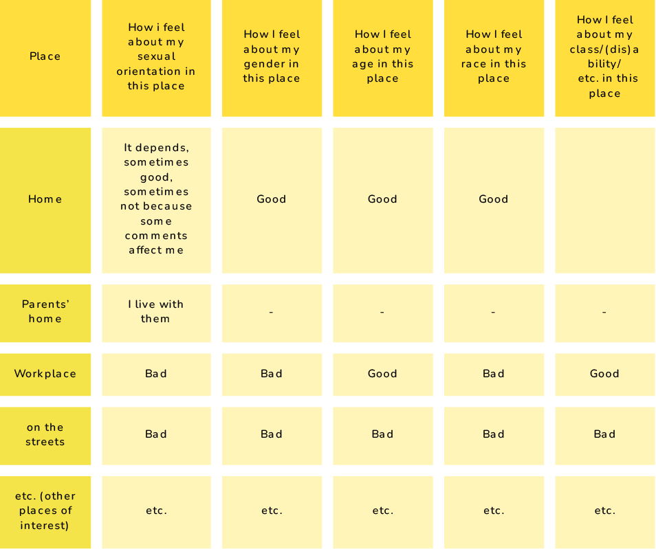
To do this, first proceed to make an analysis of how you feel (wellbeing/discomfort) in different places (e.g., your home, your work, your family of origin’s home, the street, etc.) with respect to different dimensions that construct you as a social subject (gender, raciality, age, sexuality, social class, etc.).
Then draw an outline using different colours to build your “relief map”.
Remark
Step 2:
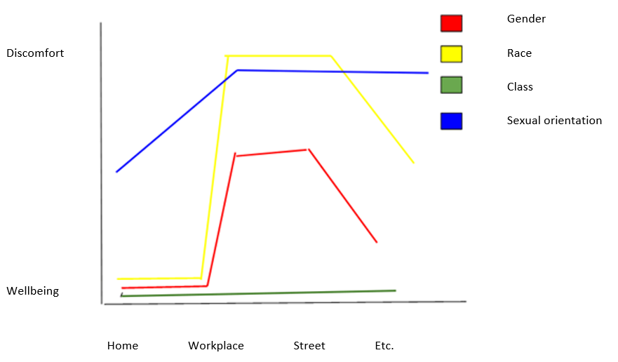
This is what Maria’s relief maps would look like:
References/resources for further work on the subject
- Habimana-Jordana, Teresa, and Dan Rodríguez-García. 2023. “Mixedness and Intersectionality: The Use of Relief Maps to Understand the Experiences of Multiracial Women of African Descent in Spain” Genealogy 7, no. 1: 6. https://doi.org/10.3390/genealogy7010006
- Relief Maps
- [Spanish] “Ejercicio de reflexión”, 2019, Desirée Bela-Lobedde (dirigido especialmente a mujeres blancas)

